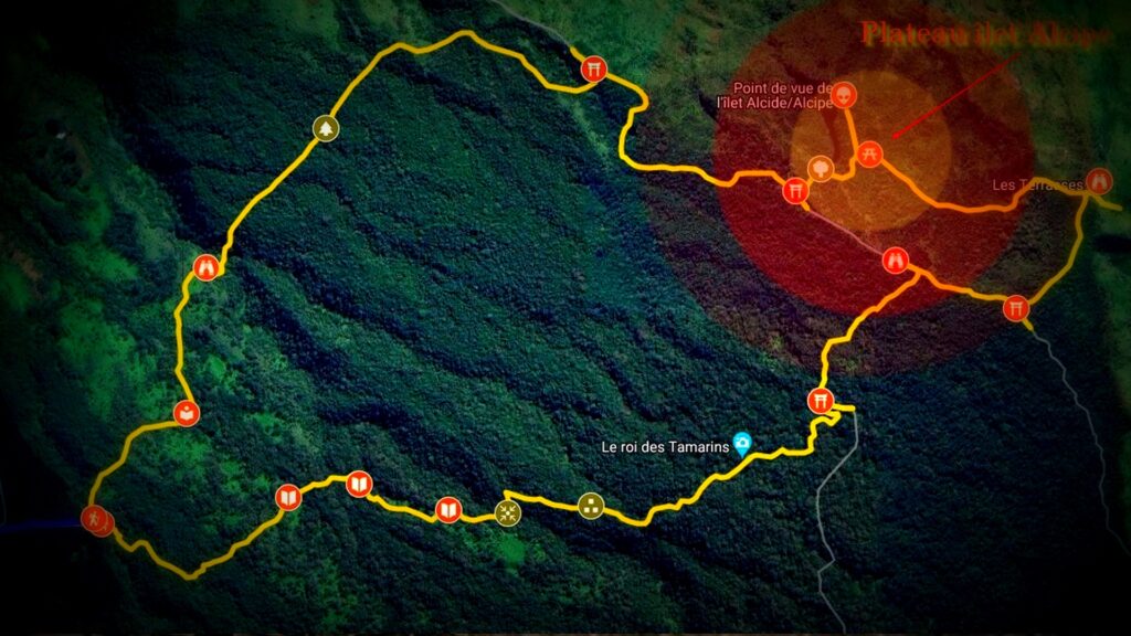
- La boucle îlet Alcipe.
BALADE, HISTOIRE, DÉCOUVERTE.
Localisation îlet Alcipe.
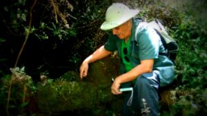
Résumer : L’îlet Alcipe, cité à tort alcide, au lieu Alcipe, a été réhabilité par René Grimaud. Suite à une mauvaise prononciation entre 2017 et 2020, son nom a été corrigé et officialisé sous le titre îlet Alcipe. Un panneau fut installé le 31 décembre 2020 par l’Office national des forêts (ONF), mentionnant le nom du personnage Alcipe Vincent, qui est lié à l’histoire du lieu.
Itinéraire îlet Alcipe :
L’îlet Alcipe, est un lieu chargé d’histoire, témoignant de la période de marronnage du début du 18e siècle, jusqu’au milieu du 20e siècle, notamment durant l’essor de la culture du géranium dans la région des hauts de secteur de Bois de Nèfles.
Pour atteindre le site îlet Alcipe, il est nécessaire de suivre le sentier d’époque de la période du géranium, qui vous conduira à travers des paysages magnifiques et des découvertes enrichissantes.
Vous avez le choix pour accéder au plateau îlet Alcipe, via le sentier principal, le chemin de Bois de Nèfles, et le sentier sans6souci que nous ne traiterons pas.
- Axe principal.
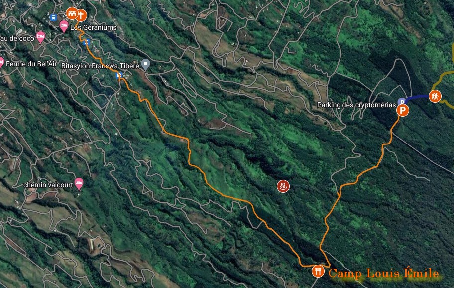
Pour accéder au sentier îlet Alcipe, vous disposerez de trois axes. Le premier consiste en l’axe principal, qui monte sur la route vous conduisant au Maïdo, village petit-france. Ensuite, le chemin forestier des cryptomérias, situé au-dessus du restaurant Doudou, qui vous mènera vers le parking. et c’est par là que débute le sentier principal, menant sur le site par la boucle îlet Alcipe.
- L’axe secondaire pour rejoindre le sentier de l’îlet Alcipe.
Vous pouvez accéder au point de départ du sentier pour l’île Alcipe depuis le quartier de Bois de Nèfles ou le village Bél-Air.
- Depuis le Bois de Nèfles.
À partir du quartier de Bois de Nèfles, vous pouvez rejoindre le début du sentier îlet Alcipe en empruntant le chemin forestier de FIOGA Bois de Nèfles. Cet itinéraire vous conduira jusqu’au chemin cryptomeria Ravine bassin, et ensuite au parking. Toutefois, cette partie en hauteur n’est pas bien entretenue pour les voitures impossibles, mais la randonnée est toujours possible à pied.
- Faire, Depuis le village Bél-Air.
En partant du village de Bél-Air, nous avons l’opportunité d’accéder au sentier îlet Alcipe, exclusivement réservé aux randonneurs. Ce sentier commence à la croix des martyrs située au village, à l’intersection du chemin des barrières et du chemin Lebel. Sur cette section, vous parcourrez un itinéraire riche en histoire lié aux événements marquants de Bél-Air.
Pour plus de détails, consultez la page Piton Calebasse.
Pour réaliser la randonnée sur cet itinéraire, vous pouvez aussi prendre le bus du réseau Kar-Ouest depuis la gare de Saint-Paul et descendre à la Croix Marty, chemin Lebel des barrière Bél-Air. Ensuite, engagez-vous sur le chemin valin, Kamalon, en passant par Piton Calebasse, jusqu’à atteindre le chemin forestier des Cryptomeria au niveau de Camp Louis Émile.
Je vous remercie pour votre visite.